Iceland starts erupting

Depending on the longevity of the eruption, the lava may flow into the sea, east of Grindavik.
1710712681960.png
1710712785486.png
 
Iceland is a very small country. And frought with volcanic activity. People here in the US frequently build in flood zones. I have a hard time feeling as sympathetic for those people. Over 15 years ago I went looking for a house in a differemt state. I had to learn about flood zones and such. Clearly NJ has areas like that too. I live less then 100 feet from a waterway. Yet in all the "super" storm activity we've had in recent years, not 1 blade of seaweed has washed up on ths properry. Some people build in areas knowing full well it's prone to flooding, or other natural disasters. I'm sorry but there are consequences for your actions, especially when your actions are careless.

I looked at properties and knew people who lived in houses where rivers would swell and the waters would rise to their eves. I would not live with that under any circumstances. I also wouldn't build on the backside of a volcano lol. But not knowing enough specifically about Iceland amd it's areas, I'll simply accept those residents are unfortunate victims.
 
When I was a child, 60 years ago, I lived on an island in the middle of the Pacific Ocean. It was 5 or 6 feet above sea level. Any decent storm and there was seaweed in our yard. We were maybe 150 feet from the ocean side in one direction and maybe 800-900 feet away from the lagoon on the other side. The island was Kwajalein, in the Marshall Islands, 9 degrees north of the equator. Had there been a typhoon, it might have been curtains for us. We weren't careless, we were stationed there.

I also don't like to be in a flood zone, so I studied the maps before buying property.

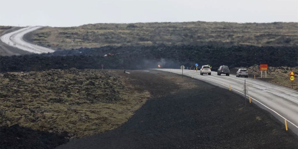
All that being said, it's easy to be glib about not living someplace. The people in Grindavik and nearby hadn't experienced an eruption in roughly 800 years, that's a whole lot of generations to get used to the way it was (eruption free). Iceland is a small country, at the junction of three tectonic plates. It's always been volcanic. But it hasn't been volcanic in that area for 800 years.

So, I do have a lot of sympathy for the people there, who are trying to survive in an area that is nearly 66 degrees north. It's a tough life there, the winters are long and dark, there's not much forest there, (all logged), in many areas it takes centuries to grow grass again, there's no growing season for agriculture, (most food is imported) and most people are working in fishing related industries (or tourism). My wife and I visited in August last year. It's an interesting place, and amazingly beautiful. But it's a tough place to live. Summer makes things look pretty good there, (it was 50F) but summer is gone in a flash. The Icelanders seem to want to look after their less fortunate brethren, which to me seems like the right and kind thing to do.
 
Last edited:
As I said, not knowing any specifics, they were likely victims. That's a far cry from building a beach house in an area known for catastrophes.

In all fairness though, Long Island, where I grew up, has had horrific storms on the east end in particular in the early 20th century. I'll likely never live there again, but growing up there has made me appreciate the entirety of the island. To say people shouldn't live near the shore and such is just preposterous. I don't mean it's kosher to build in know frequent flood zones. But certain regions are prone to that 1 per century catastrophe. I guess insurance should be liable for much of that.
 
Iconic photo of Reykjavik, lit up by the the eruption near Grindavik, March 16, 2024.
1710725490328.png
One of the live cameras, which is still streaming now. Looks pretty active at the moment!
 
Current lava map March 18, 2024. Thick red line is the current erupting fissure. Orange is the new lava flow of the this eruption (at least in the south). Arrows show the direction of the lava flow, both the the west and to the south. The orange lines are the barriers that were constructed to guide or keep the flow away. The lava has slowed down. It is unknown if it will make it to the sea and wipe out the settlements near Hraun. Hraun in Icelandic means lava.
1710796311871.png
From https://icelandmonitor.mbl.is/news/...hat_sudurstrandarvegur_road_will_not_be_impa/
 
Probably old hat to everyone, but you can run Google translate on whole web pages. The Icelandic version of the Met Office page is more descriptive than the English language one and is updated more often. Cool satellite picture showing the ground is inflating even though the fissure has been erupting.

And the eruption is still going, you can see the webcams at: https://www.ruv.is/english/2023-11-16-three-webstreams-of-the-eruption-are-available-397300
 
It's Friday March 22, 2024 and the lava is still coming up. Less than before, but it's still erupting. Very few earthquakes, just lava oozing up from the depths.
 
It's still going. Like the Energizer Bunny. Lots of sulfur dioxide emissions.

The flow rates are way down, but it is making it up simply by its longevity. Latest lava map. The cross hatched area is the new lava flow within the time 20 March to 26 March. Land under the power plant is slowly rising again, but it is significantly slower than the rates seen this winter. (That area is covered by the map legend.)

The lava also filled in a mine that was used to pave roads, I think that's in the enclosed red area surrounded by the purple. In any case the mine was near Hagafell.
1711552695592.png
 
This is a video from a few days ago, which I find utterly mesmerizing as it has sound, sounds of the eruption, not blathering. There are three active vents.
As of today, only two vents are active. At around 7.5 minutes in the video part of the wall of the volcano starts to fall into the lava. Pretty amazing. The video gives you a small feel of the power of the volcanos.
 
Back
Top